
A colored difference map is not proof of physical change
Overlaying two point clouds and coloring distances is straightforward. Differences may reflect movement, coordinate errors, registration, viewing geometry or missing coverage. The engineering question is whether the same physical surface is being compared in the same reference frame. A persuasive visualization cannot independently support a structural conclusion. Raw observations and processing steps must remain reviewable so an apparent change can be investigated rather than accepted because it looks convincing.
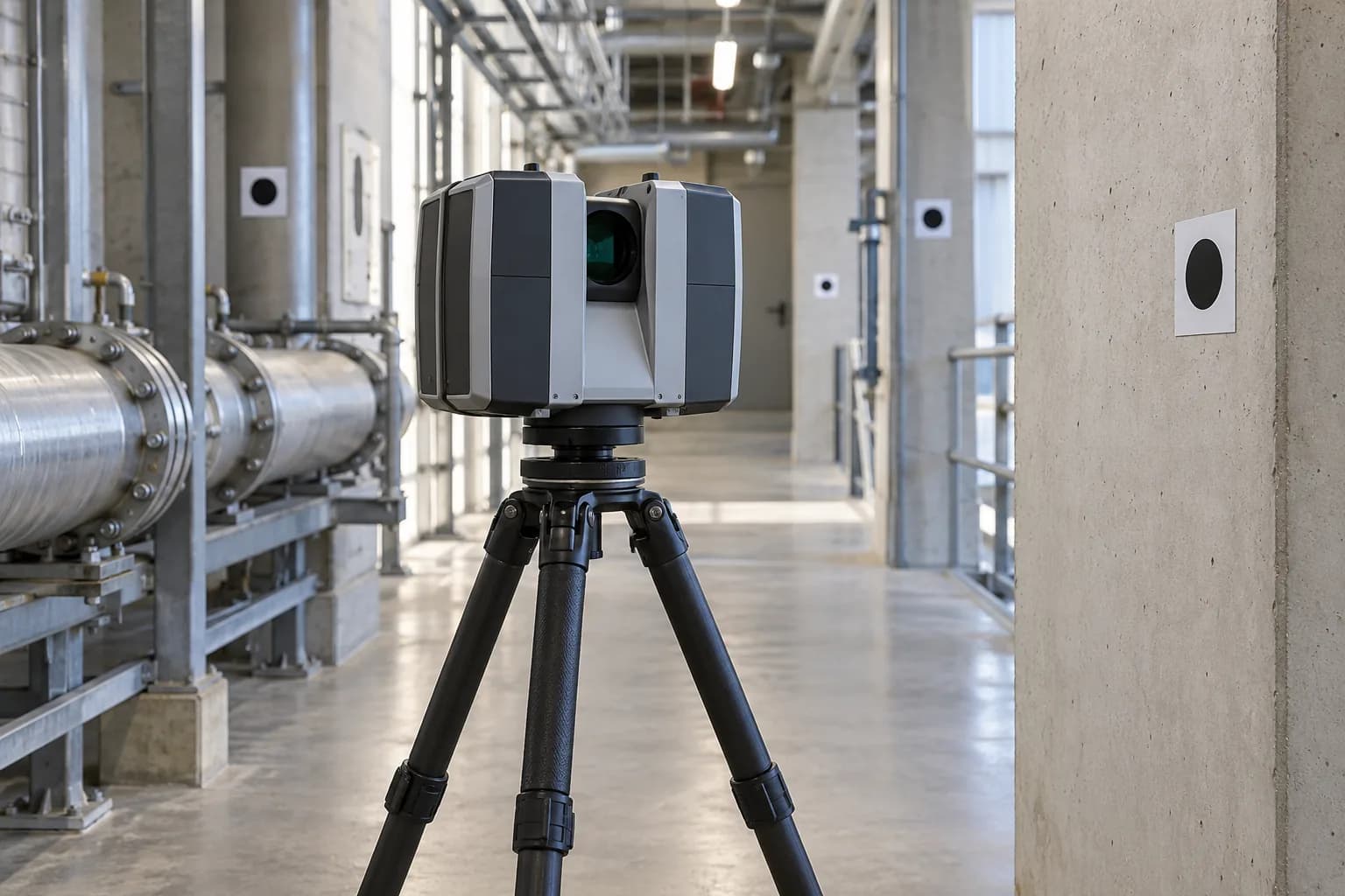
Confined-space inspections make this distinction especially important. Repeating surfaces, restricted views, reflections and carrier motion can complicate registration. Each survey retains mission identity, timing, sensor arrangement and calibration. Performance in one passage cannot establish identical accuracy for another surface or platform. The numerical examples are hypothetical explanations, not accuracy, range or delivery specifications for a Gokbilge Tech platform.
Units, coordinate frames and the transformation chain
Sensor, platform and site frames are distinct. Transformation direction, axis order, handedness and units need documentation. Mixing millimeters and meters creates an obvious error; applying the inverse transformation incorrectly can be subtler. On a moving carrier, pose changes over time. One static transform cannot explain motion throughout a scan, so timing is part of the geometry rather than merely an administrative timestamp attached afterward.
Every transformation step is versioned. Remounting a sensor or moving a control target can alter comparisons with earlier surveys. Reference stability needs independent checking; a small registration residual cannot establish that the reference itself is correct. When linking a local scan to a site frame, retain the reference definition, method and uncertainty alongside the result, rather than keeping only a transformed file whose processing history has been lost.
What does the registration algorithm actually minimize?
Methods such as ICP help align point clouds under suitable initialization and correspondence assumptions. A low residual does not guarantee the correct physical match. Repetitive geometry, limited overlap and poor initialization can produce a local solution. Point-to-point and point-to-plane objectives behave differently. Record thresholds, sampling and outlier filters; an algorithm's convergence flag alone is not adequate acceptance evidence for the physical survey.
Using the suspected changed surface for alignment can partially absorb the change itself. Stable control regions and inspection regions should be distinguished. Check residuals on controls withheld from fitting; fitting residuals are not independent validation. Report overlap and excluded areas. A large number of points does not remove this requirement because many observations can repeat the same systematic bias rather than provide independent confirmation.
Section references: Point Cloud Library · Iterative Closest Point ↗
Repeatability and accuracy are different properties
A sensor may produce similar repeated results while remaining biased relative to a reference. Repeatability alone does not expose that offset. Range, incidence angle, surface, vibration and reference uncertainty need separate review. One catalog specification cannot stand in for the uncertainty of the integrated survey system. Mounting, motion and transformations contribute additional errors. An independent reference provides evidence different from repeating a scan with the same instrument.
Uncertainty components sharing a source cannot automatically be combined as independent. Two surveys tied to one control network may share errors that cancel partially or propagate differently. Covariance assumptions must be stated. The root-sum-of-squares example here assumes independent standard components and is not a complete three-dimensional surface estimator. Interpretation depends on the measurement method and inspection question; an arbitrary global threshold is not appropriate for every condition.
Section references: NIST · Measurement uncertainty ↗
When does an 18 mm difference justify further review?
Consider a hypothetical one-dimensional comparison with positions of 1,000 and 1,018 mm. Assume standard-uncertainty components of 3 mm for each measurement and 4 mm for registration. Under independence, the combined value is approximately 5.83 mm. Choosing twice that value, about 11.66 mm, as a review screen sends the 18 mm difference to investigation. It does not establish damage, cause or an automatic confidence level.
Under the same assumptions, a 5 mm difference remains unresolved rather than being reported as zero change. If both surveys did not observe the region, no difference is assessed. The code distinguishes review, unresolved and unobserved outcomes. This prevents a blank map area from becoming an unsupported no-change claim. A complete implementation also considers surface normals, roughness, observation dependence and coverage; the example intentionally has a narrow scope.
| Input | Result | Interpretation |
|---|---|---|
| 18 mm, observed in both scans | Review | Independent investigation required |
| 5 mm, observed in both scans | Unresolved | Not evidence of zero change |
| No common coverage | Unobserved | No supported difference assessment |
const assert = require('node:assert/strict');
// One-dimensional illustrative screen, not a full point-cloud estimator.
function assessChange({ firstMm, secondMm, uFirstMm, uSecondMm,
  uRegistrationMm, observedBoth, k = 2 }) {
  if (!observedBoth) return { status: 'unobserved' };
  for (const value of [firstMm, secondMm, uFirstMm, uSecondMm,
    uRegistrationMm, k]) assert(Number.isFinite(value));
  assert(uFirstMm >= 0 && uSecondMm >= 0 && uRegistrationMm >= 0);
  assert(k > 0);
  const differenceMm = secondMm - firstMm;
  // Assumes independent standard-uncertainty components, no covariance.
  const standardMm = Math.hypot(uFirstMm, uSecondMm, uRegistrationMm);
  const screenMm = k * standardMm;
  return { differenceMm, standardMm, screenMm,
    status: Math.abs(differenceMm) > screenMm ? 'review' : 'unresolved' };
}
const input = { firstMm: 1000, secondMm: 1018, uFirstMm: 3,
  uSecondMm: 3, uRegistrationMm: 4, observedBoth: true };
const result = assessChange(input);
assert.equal(result.differenceMm, 18);
assert(Math.abs(result.standardMm - Math.sqrt(34)) < 1e-12);
assert.equal(result.status, 'review');
assert.equal(assessChange({ ...input, secondMm: 1005 }).status, 'unresolved');
assert.equal(assessChange({ ...input, observedBoth: false }).status, 'unobserved');
assert.throws(() => assessChange({ ...input, uFirstMm: -1 }));
assert.throws(() => assessChange({ ...input, k: 0 }));
console.log(result);
Point density and unobserved surfaces
Nearest-point distance is not always surface displacement. Around edges, pipes or partially visible regions, a point may match a different physical feature. Downsampling can remove detail, while high density cannot fix a biased viewing angle. Resolution follows the inspection question. Assessing a crack and assessing the position of a broad wall need different evidence, so coverage limitations remain explicit rather than being hidden by a dense rendering.
Coverage masks, low-confidence areas and filtered observations accompany the result. Color scales need clear interpretation; automatic scaling can make noise look dramatic. A reviewer should be able to open the corresponding raw observations for a region. Linking the finding to mission, time and sensor context creates stronger evidence than sharing a colored image alone. Sensitive site details remain within the agreed project scope and are not exposed in public content.
Acceptance planning for a repeat-survey pilot
A pilot includes stable regions, independent references where practical and repeated missions under selected conditions. Fitting controls and validation controls remain separate. Errors are examined by range, surface and coverage. Failed registration remains visible and may become an explicit do-not-assess condition. The report therefore covers method limitations as well as successful scans, allowing acceptance to reflect the actual evidence rather than a curated set of favorable examples.
Acceptance is not a repetition of a sensor's catalog figure. It describes the integrated system, mission, environment and uncertainty. It defines conditions requiring reviewer intervention or resurvey. Observed errors do not become a guarantee for every platform or future mission. The checks below help scope the engineering discussion; site risk assessment and physical safety requirements remain separate from the validity of a point-cloud comparison.
- Are coordinates, units and transformations versioned?
- Were withheld controls and common coverage examined?
- Are uncertainty assumptions and unobserved regions explicit?
- Can a finding be traced to both raw surveys?
Connect LiDAR integration with measurement and evidence management
Gokbilge Tech approaches LiDAR through integration of sourced sensing, carrier and communication components, mission software, remote collection and central review. Software and hardware knowledge supports coherent timing, calibration and evidence records. This scope does not imply manufacturing every drone component or delivering autonomous navigation. Measurement performance still requires evidence from the selected components, integration and mission conditions.
An initial discussion can examine the inspection question, access conditions, available reference and uncertainty required by the decision. A fixed bench or controlled environment may be evaluated before a moving platform. The inspection plan defines requirements for common coverage and independent references from the start. Engineering scope connects the decision to measurements, processing methods and acceptance limits so findings remain traceable and can be reassessed centrally when additional evidence or revised processing becomes available.
Technical references
Want to apply this approach to your system?
Discuss your technical requirements →